Amman is Jordan’s capital and largest city. It lies in the country’s north-central highlands, east of the Jordan Valley and roughly 35 km north of Queen Alia International Airport. On a regional map, it sits in the Middle East, about 70 km east of Jerusalem as the crow flies and far inland from both the Mediterranean and Red seas.
The city’s approximate coordinates are 31.95° N, 35.91° E. Those numbers place it on an elevated limestone plateau rather than in the low Jordan Valley or the great desert landscapes farther south and east. Central districts generally stand around 750–1,000 m above sea level, although elevations vary from one hill to another.
That highland position explains much about a visit: cooler evenings, steep streets, broad viewpoints and quick road access to northern and central Jordan. It also makes the capital a practical first stop for journeys to Jerash, the Dead Sea, Petra and Wadi Rum.
Where is Amman on the map of Jordan?
Jordan is bordered by Syria to the north, Iraq to the east, Saudi Arabia to the east and south, and Israel and the West Bank to the west. Amman occupies the populated highland spine in the north-central part of this compact country. It is the administrative center of Amman Governorate as well as the national capital.
To the west, the terrain descends sharply through valleys toward the Jordan River and the Dead Sea, the lowest exposed land area on Earth. North of the capital are the greener uplands around Jerash, Ajloun and Irbid. The drier plateau extends east toward Azraq, while the main highways south lead to Madaba, Karak, Petra, Wadi Rum and Aqaba.
Amman has no beach or seaport. Jordan’s only coastal city is Aqaba on the Red Sea, more than 300 km south. The capital is also not surrounded by rolling sand dunes: its landscape is a dense, pale-limestone city spread across ridges and valleys at the edge of a semi-arid plateau.
Jordan’s capital city, population and regional importance
Amman is Jordan’s political, economic and cultural center. The royal court, parliament, ministries, major universities, hospitals and many national businesses are based here. Its metropolitan population is commonly estimated at about four million, making the urban area home to a substantial share of Jordan’s people.
The modern capital grew rapidly during the 20th and early 21st centuries as Jordanians moved from rural areas and successive communities arrived from across the region. Today it is a diverse Arab city whose neighborhoods range from historic downtown Al Balad to Jabal Amman’s older villas and the newer commercial districts of Abdali and Sweifieh.
Arabic is the official and everyday language, while English is widely understood in hotels, restaurants and visitor services. The currency is the Jordanian dinar (JOD). Jordan uses Arabia Standard Time, UTC+3, throughout the year; travelers should still confirm the current time setting before a flight or fixed appointment.
Why is Amman known as the city of seven hills?
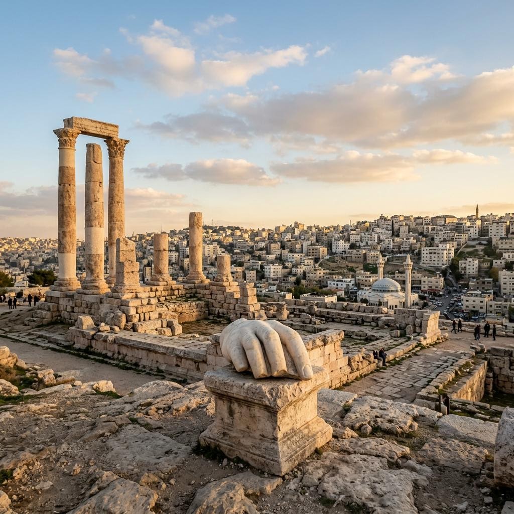
Ancient Amman developed around seven hills, or jabals. The modern metropolis has expanded across more than 20, but the original description remains part of its identity. Jabal al-Qal’a, the Citadel hill, rises above the old downtown and preserves remains from the Bronze Age through the Roman, Byzantine and Umayyad periods.
The topography affects everyday navigation. Addresses often use a neighborhood, landmark and circle rather than a simple street grid. Names such as Jabal Amman and Jabal Al-Weibdeh literally identify hill districts. A destination that looks close on a map may involve a steep staircase, a deep valley or a longer road around a slope.
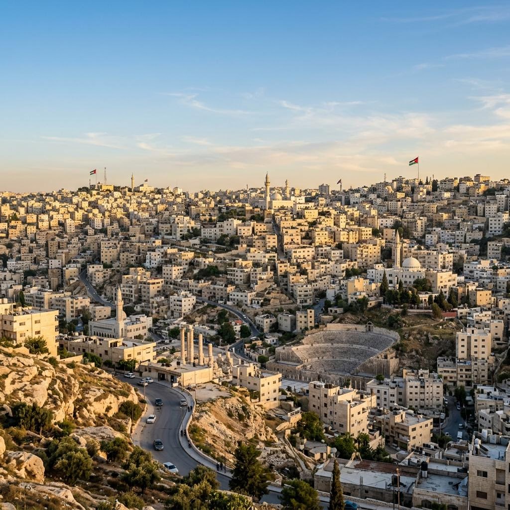
The hills also create Amman’s characteristic cityscape: tightly packed cream-colored buildings faced in local stone. Viewpoints at the Amman Citadel, rooftops in Weibdeh and terraces around Jabal Amman reveal how the urban area folds over ridge after ridge.
Climate, seasons and what the elevation means
Amman has a semi-arid, Mediterranean-influenced climate. Summers are hot, sunny and very dry, but highland evenings can feel more comfortable than the Jordan Valley. Winters are cool and wetter. Night temperatures can approach freezing, and occasional snow can disrupt roads on the higher hills.
Spring and autumn usually offer the easiest sightseeing weather. March to May brings mild days and, after winter rain, greener landscapes in northern Jordan. September to November tends to be warm and dry. Summer visitors need sun protection and water; winter visitors should bring layers and a rainproof outer garment.
Conditions change quickly with elevation. A winter day in the capital may be significantly colder than one at the Dead Sea, around 430 m below sea level. Check both locations separately rather than packing for “Jordan weather” as if the whole country shared one forecast.
How far is Amman from Petra, the Dead Sea and other places?
The Dead Sea is about 50 km west, normally 45–60 minutes by road. Jerash is around 50 km north and also takes roughly 45–60 minutes. Madaba is approximately 35 km southwest, while Mount Nebo is a little farther beyond it. Traffic at the edge of the city can change all of these times.
Petra is about 235 km south and usually around three hours by the faster Desert Highway. The scenic King’s Highway takes considerably longer because it crosses towns and winding highland terrain. Wadi Rum lies farther south, and Aqaba is roughly 330 km from the capital, generally 3.5–4 hours by road.
These distances shape sensible itineraries. Jerash, Madaba, Mount Nebo and the Dead Sea work well as day trips. Petra deserves at least one overnight in the south for most travelers, especially when combined with Wadi Rum and Aqaba.
Flights, airport location and overland connections
Queen Alia International Airport (AMM), Jordan’s principal international gateway, is around 35 km south of central Amman. The drive commonly takes 35–50 minutes but can take longer during busy periods. Airport taxis, buses, prearranged transfers and rental cars are available.
Do not confuse the airport’s location with downtown. It sits beside the main north–south highway outside the dense urban center. If your flight arrives late, confirming the hotel address and transfer in advance avoids trying to navigate hill neighborhoods when tired.
Amman’s highways connect with border crossings toward Saudi Arabia, Iraq, Syria, Israel and the West Bank, but entry rules, crossing hours and regional conditions can change. Verify official advice shortly before any land journey. For travel within Jordan, private cars, coaches, minibuses and domestic tour transport are the main options; there is no intercity passenger rail network for tourists.
A brief history behind the location
Reliable water sources and defensible hills attracted settlement here thousands of years ago. In the Iron Age, the city was Rabbath Ammon, capital of the Ammonites. Under the Hellenistic and Roman worlds it was known as Philadelphia and became one of the cities associated with the Decapolis.
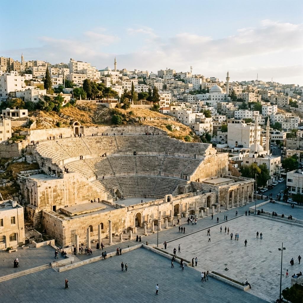
Roman Philadelphia occupied the valley and surrounding hills. The Roman Theater still anchors downtown, while the Citadel preserves the Temple of Hercules and later structures. Byzantine churches and the Umayyad Palace show that the hill remained important after Roman rule.
The settlement declined before reviving in the late 19th century, when Circassian families established communities here. Amman became capital of the Emirate of Transjordan in 1921 and later of the Hashemite Kingdom of Jordan. Its central position and road connections helped it grow into the country’s dominant city.
Using Amman as a base: practical map tips
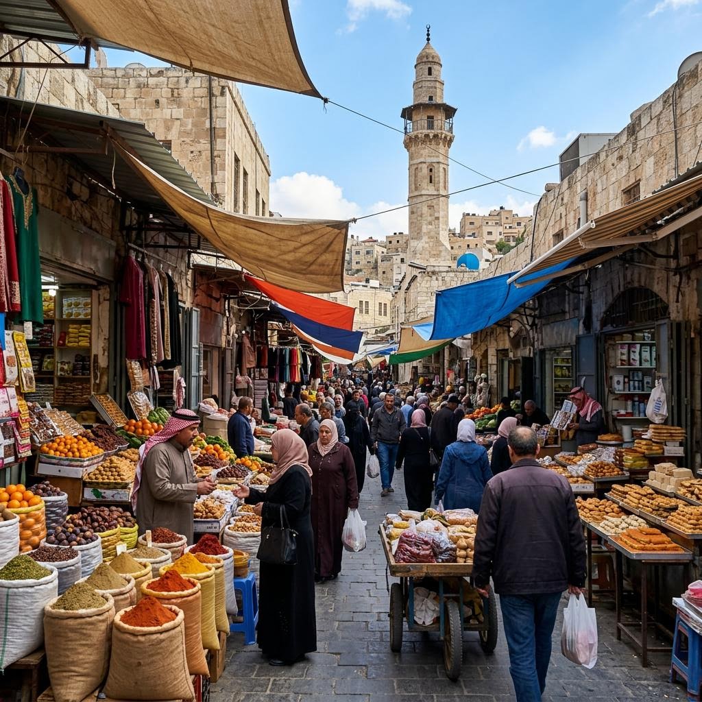
Choose accommodation by neighborhood as well as distance. Al Balad puts the Roman Theater, souks and traditional food close by. Jabal Amman offers Rainbow Street and restaurants; Jabal Al-Weibdeh has galleries and cafés. Western Amman contains many larger hotels and modern business districts but sits farther from the old-city sights.
Walking works best within a district or downhill between nearby attractions. Comfortable shoes are essential, and pedestrian crossings can require patience. For travel between hills, use a licensed taxi, ride-hailing service or private driver. Build extra time around the morning and late-afternoon traffic peaks.
A useful first-day route links the Amman Citadel, Roman Theater and downtown markets, then finishes around Rainbow Street or Weibdeh. Our Amman city tour handles the steep transfers, while the related guides below explain the capital’s neighborhoods and essential sights in more detail.
Frequently Asked Questions
Which country is Amman the capital of?
Amman is the capital of the Hashemite Kingdom of Jordan, a Middle Eastern country in Western Asia. It is also Jordan’s largest city and its main center for government, business, higher education and international transport.
Is Amman in the desert?
Not in the way many visitors imagine. The city occupies a semi-arid limestone plateau in Jordan’s north-central highlands, generally around 750–1,000 m above sea level. Wadi Rum’s dramatic sandy desert lies much farther south.
How far is Amman from the Dead Sea?
The Dead Sea is about 50 km west of the capital, normally 45–60 minutes by car depending on the starting point and traffic. The route drops steeply from the highlands to the Jordan Valley, so temperatures can be noticeably warmer on arrival.
How far is Amman from the airport?
Queen Alia International Airport is about 35 km south of the center. The road trip generally takes 35–50 minutes, although peak traffic can add time. It is Jordan’s main airport and uses the IATA code AMM.
Is Amman close to Petra?
Petra is about 235 km south, normally around three hours by the Desert Highway without long stops. It is possible to travel there in one day, but staying overnight gives visitors much more time at the archaeological site and makes a Wadi Rum extension easier.
Plan this trip with us
Ready to experience Jordan with a local guide?
We plan and run private tours across all of Jordan — one message and your trip is in local hands.
Chat on WhatsApp